Active Travel and Public Transport
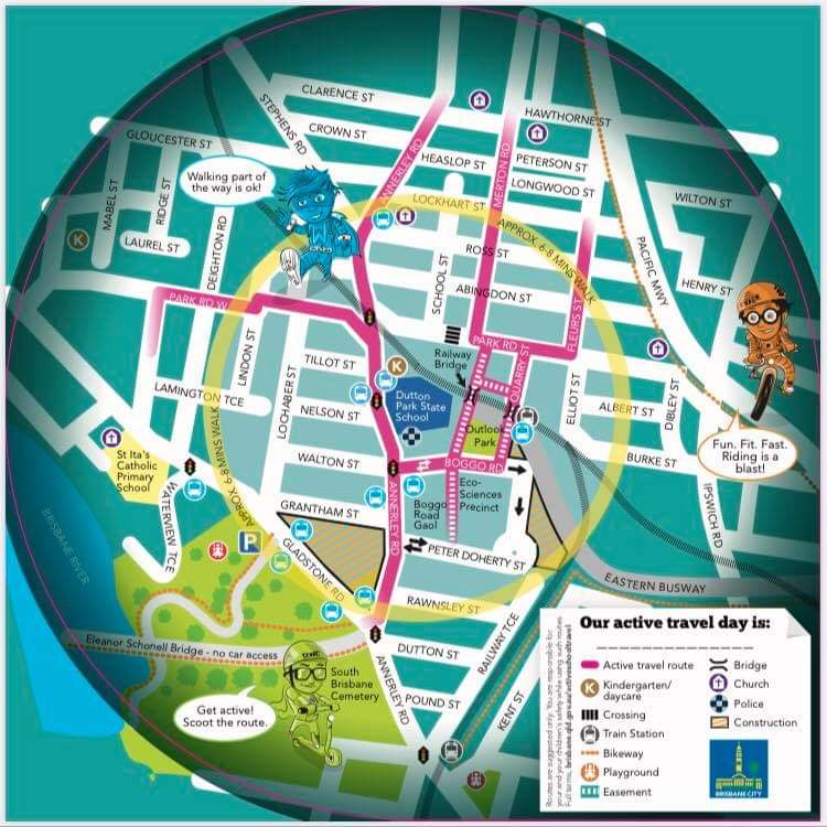
The P&C encourages all parents and students to walk / ride bikes / scooter to school where possible. The P&C supports the school in the promotion of active travel and organises a number of events through the year to encourage engagement and increase participation. Public transport is also a viable option for many families since the Boggo Road station is adjacent to the school, and there are bus routes along Annerley Road.

Driving to School
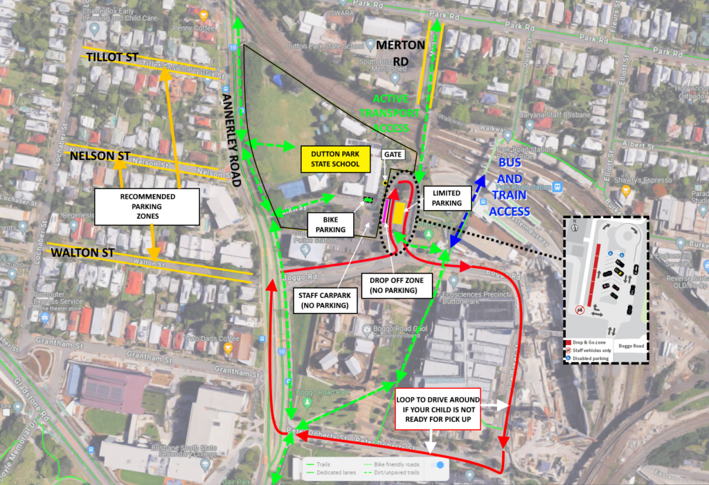
If you do need to drive your kids to school, please be aware of the parking rules and respect the proper operation of the ‘stop, drop and go’ area on the eastern side of the school in the Patricia Mather Place carpark.
- If you want to use the ‘stop, drop and go’ area, please do not leave your vehicle. If you need to park and escort your child(ren) into the school, do not use this zone.
- In the morning the zone is unsupervised, please drop your children within the zone and move on
- In the afternoon there is some supervision of the children, if your child is not ready when you reach the front of the zone you will need to complete a loop and rejoin the queue (see map below)
- If you want to park and escort your child(ren) into the school, it is recommended to park on Nelson, Tillot, Walton or Merton Streets rather than try to park in the Patricia Mather Place carpark (see yellow zones in the map below). Unfortunately the parking time limits in the council-controlled carpark are often not observed, and while the P&C has been seeking to improve both enforcement of the rules and improved courtesy via the management of nearby construction sites it is likely to be an ongoing issue.
Report Parking Violations
If you see illegal parking and/or discourteous behaviour please report the issue to Council by calling 34038888 directly, or SMS 0429 2 FIX IT (0429 234 948) with photos, details of the problem, location and your name. You can use Patricia Mather Place as the address of the carpark.

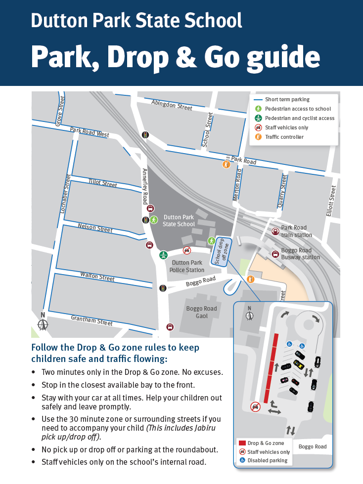
See also this map for some additional alternatives:


